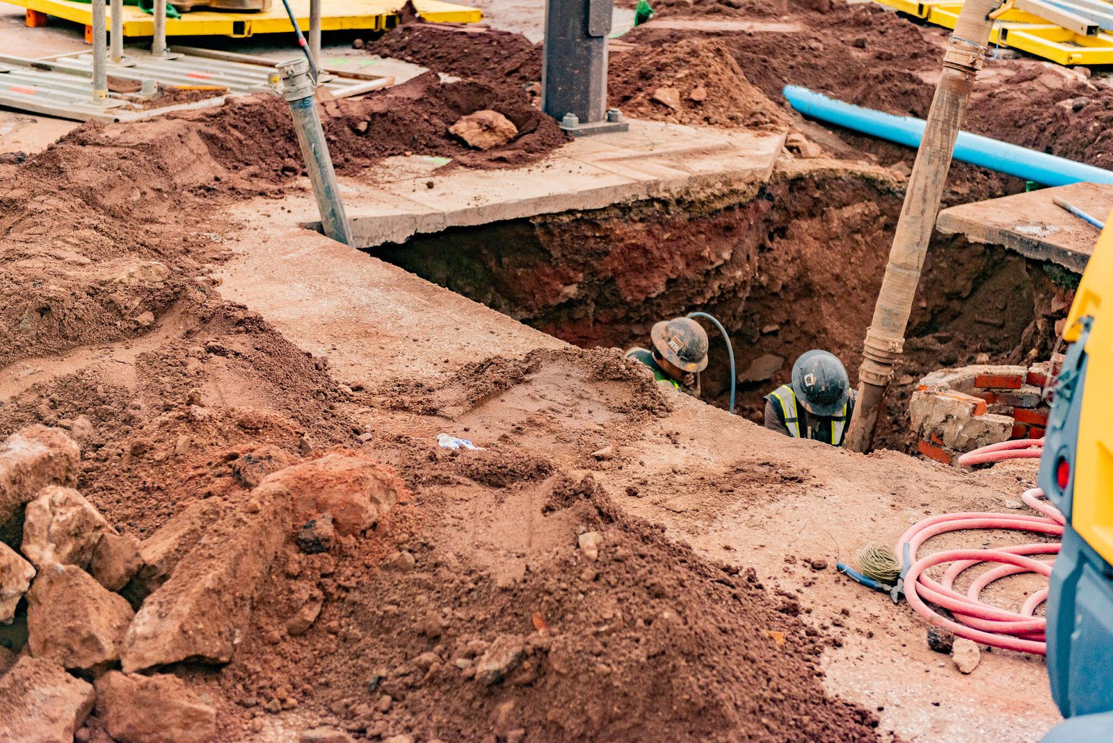
Nobody knows what is under a street until someone looks, and the cost of looking is small beside the cost of not looking. A single pothole, a 12 inch hole cut in pavement and vacuumed clean to the top of a pipe, tells a design team the depth, the size, the material and the exact horizontal position of a line that the record drawings may show a few feet away. Multiplied across a project, that information is the difference between a profile that works and a redesign after the trench is half dug.
We perform utility locating and potholing ahead of design, ahead of trenching and during construction, using vacuum excavation, electromagnetic locating and ground-penetrating radar where it helps. The product is a set of verified points, with depth, size and material, referenced to survey control and delivered in a form the engineer can use. The earlier the data arrives, the cheaper it is to act on, so we encourage owners to call us before the design is frozen.
Before any excavation, the law requires a locate request to the one-call center, and the utility owners mark their lines within a stated time. Those marks are the starting point, not the answer. They show the approximate position of a line, usually within a tolerance zone on either side of the mark, and they do not show depth. Within that zone, the rules call for careful methods, such as hand digging or vacuum excavation, until the line is exposed.
Engineers describe subsurface utility information by quality level, from records research at the lowest level to physically exposed and surveyed lines at the highest. Potholing provides the highest level, with the line exposed, measured and tied to coordinates. We log each hole on a sheet with a photograph, the depth to the top and bottom of the pipe, the material, the diameter and the pavement or soil above, and we restore the surface to the owner's standard.
Vacuum excavation uses high-pressure air or water to loosen soil and a vacuum to remove it, leaving a clean hole with no mechanical contact with the utility. It is the preferred way to expose gas, electric and communications lines, since a bucket or a spade can damage them. The spoil is hauled away or stored and used to backfill the hole after the data is recorded.
Electromagnetic locators trace metallic pipes and tracer wires, and ground-penetrating radar images plastic pipe, concrete and voids where no tracer exists. Each has limits: wet clay absorbs radar signal, rebar scatters it, and congested corridors confuse a locator. We use the tools in combination, check the results by potholing at key points and mark the findings on the surface and on a plan. Where the survey is critical, a surveyor ties each mark to the project coordinate system.
We start with a review of the plans and records to find the crossings that matter: points where the new pipe will cross an existing line at a similar elevation, spots where a trench runs parallel to a power cable, and places where a new structure will land near an old one. Those become the pothole list, and we add holes where the records are doubtful or the consequences of a surprise are large.
The results go back to the design team promptly, usually within a day, so that profiles can be adjusted while the pipe is still on paper. During construction we pothole again ahead of the machine in any area where an unmapped line is likely, and we keep the vacuum truck with the crew when the trench enters a congested corridor. The cost of that truck for a day is small beside the cost of a gas strike, and the same data feeds utility relocation decisions and the layout of the site utility package.
The Old Town historic district in Fort Collins covers roughly 26 acres, includes 38 contributing buildings and is bounded by N. College Avenue on the west and E. Mountain Avenue on the south. Streets like these have carried utilities for a long time, and lines installed in different eras, by different owners and to different standards are stacked in narrow corridors. Records from the early period are incomplete, and abandoned lines remain in the ground, so potholing in Old Town is routine before any new work.
Rail crossings add their own rules. Freight rail service in Fort Collins is provided by Union Pacific and BNSF, and in Windsor a BNSF line runs north of Main Street. Locating and potholing near rail corridors requires the railroad's permission, a flagger and sometimes a protective sleeve or casing, and these items have long lead times. We identify them at the planning stage so the schedule includes them.
Potholing is priced per hole, with adders for deep holes, pavement coring, traffic control, water or hard ground. A typical project may need a handful of holes or hundreds. The price of a program is small next to the cost of an unplanned relocation, and there is a more direct saving as well, since an exposed and measured line allows the designer to cut the clearance allowances that otherwise pile up on conservative drawings.
We advise owners to buy data before the bid, not after, so that bidders price a known condition. That is especially true for medical office pads and similar infill sites where the utilities are dense, and for work coordinated with utilities and energy companies, who often require verified depths before they approve a design.
Send the plan sheets and the areas of concern and we will propose a hole list, a schedule and a deliverable your engineer can use.
A locate is a surface mark placed by a utility owner or a private locator that shows the approximate path of a line. A pothole is a physical exposure of the line that gives the true depth and position. Locates are required before digging, while potholes are a project decision to reduce risk.
A typical hole is about a foot across, and it is backfilled with the removed soil or with flowable fill and patched to match the pavement. Pavement repairs follow the owner's standard. Holes in landscape areas are restored with soil and seed or sod.
As early as the design allows, ideally before the utility profiles are final. Data collected early lets the engineer adjust grades at no cost, while data collected after the trench is open means field changes and delays. During construction, additional holes help where the plans are uncertain.
Often, using ground-penetrating radar and a combination of other methods, but not always. Soil conditions, depth and nearby metal affect the results. Potholing confirms what the other tools suggest, and where a line cannot be found, we record that fact.
Yes, when the project calls for it. Each exposed line is tied to the project survey control with horizontal and vertical coordinates, and the log is delivered in a form the engineer can place directly on the plans.